
No doubt you’ve seen this disturbing picture from National Highways, their depiction of part of the scar they plan to inflict on the Stonehenge World Heritage site. Who couldn’t be shocked at the scale of loss?
.

.
Yet that’s only half of it, almost literally. Look carefully. Do you see a slight change in the colour of the grass on each side? That’s part of the scar. Fresh air instead of the original land surface for you can’t make a new road by cutting straight down, there’s always a slope on each side, and that of course also involves loss of archaeology. Not made clear though, is it? Why?
__________________________________________________
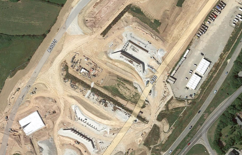
But it’s far worse:
The scar will be much much worse than that. There will also be infrastructure works for construction supplies, construction vehicle access and parking and workers’ accommodation which will all be needed (just outside the WHS but in a very sensitive area). Here’s part of the A30 improvement scheme in Cornwall (a line of lorries, top right, gives an idea of scale.)
.


1 comment
Comments feed for this article
29/06/2023 at 13:03
jr108
The image is of the proposed western approach cutting which to be fair both National Highways and the NT have tried to hide the road by culverting the cutting with retaining walls at the bottom and a sloping bank at the top. Extra ‘green-environmental landscape bridges might help, but the whole thing remains an abomination and a permanent scar across the landscape. The scheme needs throwing out and a better plan drawing up.