
You are currently browsing the monthly archive for March 2014.
Today’s article is by Andrew Heaton, the second respondent to our recent request for contributions to the Journal. (You are welcome to be the third!). He highlights a threat to a section of Offa’s Dyke. It’s not far from Oswestry Hill Fort (enough said!) You may also recall that another section of the Dyke suffered criminal damage recently. This time though the threat is legal.
[Please note that all articles by Guest Bloggers express their own views and perceptions which may or may not correspond with our own.]
_______________________________________________________________
Turmoil in Trefonen
by Andrew Heaton
There’s turmoil in Trefonen ! Under the guise of the ‘emerging SAMdev plan’, a property developer has applied for permission to build 12 homes in a field in Trefonen – a field that contains a section of nationally important and internationally renowned Offa’s Dyke. The planned development is within the setting of the Scheduled Ancient Monument and the plans show the nearest proposed house being only about 90 metres from the scheduled area and a mere 20 metres from the closest extant length. Large lengths of Offa’s Dyke were scheduled a long time ago before the importance of the less dramatic lengths was recognised and therefore this proposed housing development may be adjacent to nationally important archaeology which is not protected simply because it has not been assessed.
Clwyd & Powys Archaeological Trust (CPAT) have displayed on their website,‘Conservation Statement Offa’s Dyke ‘Conservation Statement Offa’s Dyke’’; it refers to this section of the Dyke as it heads North from Trefonen as “the monument becomes more impressive and continuous”! Not impressive enough for English Heritage it would seem !

Conceptual plan of the development – .note the close proximity of the Dyke – the closest section is just 20 metres away.
In the past, English Heritage have stated that the likelihood of finds in this field to be high. The proposed development site contains a number of potentially important archaeological features and remains, including earthworks of different dates and an ancient stone hedge. To the best of my knowledge there have been no exploratory investigations and currently, no heritage impact assessment report is available. It is clearly essential that such work should be conducted before a planning decision is taken otherwise really important archaeology could be destroyed.
The ‘emerging SAMdev plan’, enables developers to put in applications for building, on hitherto protected pieces of land. As a result of the lack of a five-year supply, the National Planning Policy Framework (NPPF) “presumption in favour of sustainable development” is now the main planning policy consideration in determining the application. The Planning, design & access Statement may be seen here.
The ‘advice’ from English Heritage with regard to this site is as follows :
‘The application area is within about 100 metres of a well preserved upstanding and scheduled section of Offa’s Dyke, national monument no 1006262. I made a pre-application site visit to the site, accompanied by the applicant’s agent on 16th January 2014 and subsequently confirm that English Heritage does not object to this application in principle. Following numerous objection comments made to the local authority and forwarded to English Heritage, we made a further site visit on 10th March and this has not resulted in changes to our view”.
I’m astounded that English Heritage should take this stance. Planning Policy Statement 5 (Development Management page 8) Policy HE9 Additional Policy principles Guiding the Consideration of Applications for Consent relating to designated Heritage Assets states that :
“There should be a presumption in favour of the conservation of designated heritage assets, the more significant the asset, the greater the presumption in favour of its conservation should be. Once lost, heritage assets cannot be replaced and their loss has a cultural, environmental, economic and social impact. ‘Significance’ can be harmed or lost through alteration or destruction of the heritage asset or development within its setting”. When substantial harm to or loss of significance is a corollary of development, the policy states “local planning authorities should refuse consent”.
_______________________________________________________________
Developments within Trefonen during the past 15 years or so have already impacted not only upon the Scheduled Monument (Offa’s Dyke) itself, but also the Offa’s Dyke footpath which has effectively been corralled into a corridor between houses. The monument is of national importance, and the attitude that has been taken by landowners/developers and the lack of control exercised on the development impacts by the Local Planning Authority are both outrageous.
Although the Dyke eventually flattens out in this field, its ditch will survive well and probably contains important and unique archaeological information together with invaluable environmental data. The physical essential form also continues down the length of Chapel Lane, where it has been built on by properties. But these sit at a raised level and allow the line and form of the Dyke to be visualised as a continuation of the linear feature when viewed from both the Offa’s Dyke Trail to the West and the main Oswestry road to the East. Originally, the Dyke ran behind Church View & Meadowlea, where the proposal has new houses and garages.
English Heritage cited the importance of this linear visual attribute, when considering recent (November 2013) Planning Application for a single dwelling just 500m from the nearby application site Ref. 13/01025/FUL, which was refused permission to be built. The proposed development is for 12 dwellings and in a more prominent position than the one refused – directly between Offa’s Dyke & Offa’s Dyke Trail Path. Yet this time, there are no objections from English Heritage. Where’s the consistency ? How may 12 dwellings have less of an impact than one ?
The proposed development is on a site of historical interest. Apart from containing a significant section of Offa’s Dyke, the field was certainly used as an enclosure for sheep and cattle, that drovers brought down from North Wales & Anglesey – yet it certainly pre-dates the Enclosure Act of 1845. The animals would be kept overnight in Trefonen and when leaving, would be taken in a south-easterly direction and thence to London.
The access point through Whitridge Way, is where there is an historic stone hedge. The Applicant implies that the existing straight boundary is associated with the previous estate development – but this is not the case ! The hedge-line is on old Tithe maps from as far back as 1838! The stone hedge has been estimated to be over 400 years old. One section of the stone hedge, has some clearly ancient and worn stone steps and a stile, which was the means by which the drovers could easily leave the field without releasing any of the animals.
Shropshire Council has a responsibility to protect our heritage; the stone hedge contributes a great deal to the local character of the area and its loss would be detrimental – all should be done to protect it. To gain access to the development, would necessitate the partial removal of this stone hedge – this is simply unacceptable!
The Conceptual plan of the development (see top pic) shows a new footpath link to Offa’s Dyke Trail Path, with possible walkers’ parking indicated. This is ridiculous ! How will visitors be expected to find it, tucked away at the end of an estate cul-de-sac ? Is it appropriate, to send more traffic up an estate cul-de-sac, searching for 5 possible parking spaces which are likely to be full when they find them ? This is just a token gesture item. Offa’s Dyke would lose its significance if a new development is built – ‘significance’ being not just the physical presence of the Dyke, but also the setting in which it exists. In the field of the proposed development, there is a stretch of very visible Dyke, which is over 100 metres long; to build houses in the near vicinity would ruin the context of this section of the Dyke.

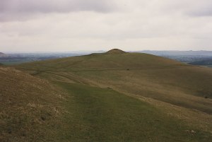
View of site as now (looking North). Offa’s Dyke indicated by red line. Walkers on the Dyke path have virtually the same view… at present, but 12 houses built within the yellow box would of course destroy it.

A view from on the Dyke (looking South). New houses would be just 75 metres from it (by the yellow line).
.

The view from the proposed site of a new dwelling – looking North, back at the Dyke (red line), just 75 metres away; but note, that the nearest section is just 20 metres away.
Paragraph 123 of the NPPF states that planning policies and decisions should aim to: “identify and protect areas of tranquillity which have remained relatively undisturbed by noise and are prized for their recreational and amenity value for this reason. “This area is currently a particularly tranquil part of the village, located alongside the Offa’s Dyke monument and is bordered by the narrow Chapel Lane to the East and the Offa’s Dyke long distance footpath to the West. Both are well used for quiet, passive recreation by villagers and visitors alike whilst taking in the local views and natural environmental features.
Some readers of this article may feel that I’ve been ‘unfair’ to English Heritage. In a sense, that may be true; after all, when we consider such aspects as ‘importance’, ‘context’ and ‘setting’, these are very much subjective opinions. The view from English Heritage, is that building 12 houses within 20m of the Dyke is ‘acceptable’; my view differs, but who is right? There are, however, a considerable number of material objections that may also be made, by referring to tangible & quantifiable facts. Since these are beyond the scope of this article, I’ll provide just one brief example.
Shropshire County Council Highways Specification for Residential/Industrial Estate Roads Feb 2000 Section 2.3.5 Access Road (4.8m wide) states that“A standard access road is a short cul-de-sac giving direct access to no more than 50 dwellings. The normal maximum length permitted is 100 metres, if not a loop”. At 130m long, the current estate cul-de-sac is already well over the 100m maximum length. The extension will add on a further 80m, making an extended total of 210m ! (It cannot be made a loop). At over twice the normal maximum length, will the cul-de-sac be built ? Will Shropshire Council take any notice of their own Highways specifications ? I’d be willing to bet good money, that they’ll ignore their own ruling.
The ‘need’ to build more houses, is the over-riding priority. The willingness of Shropshire Council, to ignore facts – even their own, typifies the kind of thing that we are fighting against; not just the villagers in Trefonen, but in many other towns and villages across the nation. I’m convinced that this will (deservedly) ‘hurt’ the government at the next election.
Should developers be allowed to put 12 dwellings so close to the Dyke ? Should the field be ‘Open to Offa’s?’ If anyone can help us to fight this case or tell us more about the significance (if any) of stone hedges, please contact me – pubrunner2000@yahoo.com
by Nigel Swift

We’ve had some clues lately. We now know Responsible Detecting is NOT digging up German soldiers using unqualified people and disrespectful behaviour to make a crass TV show called “Nazi War Diggers”. Nor is it digging up treasure from what was perceived to be a grave in Kent instead of leaving it to professionals. (Although, bizarrely, PAS is yet to condemn the latter and many detectorists have said both incidents were “fine”!). Personally I think I know exactly what the term means. It means working for the public’s benefit, not your own. I’m confident every archaeologist thinks that too but in Britain there’s a political and tactical need to avoid offending artefact hunters so most of them don’t express it, not in in public anyway. Eight words unsaid, that’s what makes Britain’s portable antiquities policy bonkers for it lets anyone claim “responsible detecting” is whatever it suits them to say it is.
Three detectorists have just illustrated the fact. The worst says a responsible detectorist simply “adheres to the letter of prevailing laws“. (Yeah right, the laws that leave you free to not report 99.9% of finds and indeed to put them into a crusher!). Another says you should report your finds but that the NCMD code is fine (even though it doesn’t require you to report 99.9% of finds!) The third says you should avoid damage and report your finds – and to signal that belief he has resigned from NCMD. So he’s the only one of the three that comes within a million miles of responsible but he’s hardly typical. It’s the same with detecting clubs. All say they favour responsible detecting yet all but one don’t insist on Members adhering to the official Code or reporting 99.9% of finds. They tell farmers their Members are code-bound and responsible but they don’t tell them that!
Thus the claim “I’m a Responsible Detectorist!” acts as a magic open sesame at farm gates. All the farmer knows is what he is told in the press ad nauseam, that there are just two sorts of detectorists – a tiny minority known as nighthawks and all the rest, who are “responsible”. If only, if only officialdom and more archaeologists would stop saying that and tell landowners the real truth (an article in the farming press perhaps?) that “the rest” comprise every shade of responsible and none and that the term can only mean protecting the public’s interest. How about “The deliberate recovery of buried portable antiquities always involves the unearthing of knowledge and no-one should annexe, conceal or destroy it.”? Which bit of that should landowners not have been officially told all these years? It would make such a difference to conservation if they were. But not upsetting detectorists seems to outrank conservation or telling farmers the truth in many official quarters in Bonkers Britain.
**************************************
Keep calm and carry on. Nothing to see here. Agenda driven amateurs eh? Tsk!
__________________________________________
More Heritage Journal views on artefact collecting
__________________________________________
During a recent holiday in Cornwall, I took the opportunity to revisit Carwynnen Quoit, to see what progress had been made since my previous visit during the recent excavations. Seeing one of the uprights back in place has prompted me to put together this brief overview of the history of the quoit.
Built some time between 3500-2600 BC, this Cornish dolmen had (presumably) stood for millenia before its collapse and reinstatement in the early 1840’s. The recorded history of the quoit begins in the early 18th century, mentioned by Edward Lhuyd during his Cornish travels. It was later drawn by Dr Borlase, and this illustration was included in W.C. Borlase’s ‘Naenia Cornubia’in 1872. J.T. Blight’s ‘Ancient Crosses of West Cornwall’, published in 1858 also includes an illustration of the quoit, somewhat different from that drawn by Borlase.

‘Caerwynen’ by Blight, taken from ‘Ancient Crosses of West Cornwall’.

‘Caerwynen’ by Dr. Borlase, taken from ‘Naenia Cornubia’, by W.C. Borlase.
A section of the capstone broke off when the monument fell in 1842, and during its reconstruction “by workers on the Pendarves Estate and local people, galvanised by Mrs Pendarves”, one of the supporting stones was reduced in height and the arrangement of the uprights was thus changed. Comparing this reconstruction to the original, W.C. Borlase noted:
The two supporters at the south-eastern end seem to have retained their original positions. They were, formerly, respectively 5 feet 1 inch, and 5 feet 2 inches above ground, and are still nearly the same height. The single pillar at the other side has been moved nearer the edge of the covering stone than in the above sketch; it measured 4 feet 11 inches high, but is now shorter. The covering slab, which, like the other stones, is granite, measures twelve feet by nine; one side, however, seems to have been broken in its fall.
The monument seems to have remained in this state for around 124 years, until in 1966 it collapsed again, reputedly due to an earth tremor. With thanks to Paul Phillips and the folks at the Sustainable Trust, we have photographs of the quoit taken a short time prior to it’s later collapse.

Carwynnen in the 1960’s. © Paul Phillips

Carwynnen in the 1960’s. © Paul Phillips
After the collapse, the Pendarves estate declined, and what were once the landscaped gardens of the estate were returned to agriculture. The collapsed stones were piled in a heap, and with repeated ploughing more stones came to the surface, to be added to the pile of ‘field clearance’.
My own first view of Carwynnen came in May 2007, whilst trying to ‘tick off’ all the Cornish quoits. There was actually very little to see – a field of scrub, with a few stones almost hidden amongst the weeds. But the site was purchased in 2009 by the Sustainable Trust and their partners, and plans were immediately put in place to once again restore the quoit to it’s former glory.

The stones at Carwynnen May, 2007.
I returned in 2012, to find on the surface very little had apparently changed, the pile of stones was still there, looking much as before.

The stones at Carwynnen, May 2012.
But now there was a noticeboard at the entrance to the field, indicating that the plans were very much under way. Later that year, two excavations were held in the field. The first was a preliminary investigation via a series of test pits. The stones were then moved using a crane, from the place where they had been left after the 1966 collapse, in preparation for the ‘Big Dig’ in the autumn.

Carwynnen stones, all nicely sorted and categorised, October 2012.
In April 2013 I returned again, to attend ‘Quest for the Quoit’ a neolithic exhibition of crafts and an archaeological test pit dig. This was just one of a series of events and exhibitions both at the Quoit and around various parts of Cornwall to advertise what was going on, and to get the community involved. The day was a great success with a lot of local interest and involvement. And of course, the ‘Big Dig’ had provided the perfect surprise with the discovery of the original footprint of the monument, and the stone ‘pavement’, the original chamber floor. A year after the excavation of the original socketholes, in October 2013, the first of the uprights was put back up into place.

Carwynnen, the first upright, upright! (March 2014)
Although it looks quite forlorn, locked away inside it’s protective fencing, the other two uprights are scheduled to be raised to join it in May this year, followed by the placing of the capstone at Midsummer. I hope to be there to witness that.
Further details about the history, excavation and events at Carwynnen can be found on the project website at http://www.giantsquoit.org
Unless otherwise stated, all photos © Alan S.
Carwynnen Quoit is situated a short distance south of Camborne, in Cornwall. OS Grid Ref: SW650372, Sheet 203.


Snip! Snap! Snip! the scissors go;
And Conrad cries out – Oh! Oh! Oh!
Snip! Snap! Snip! They go so fast;
That both his thumbs are off at last.
Some say “The Scissorman” is a real person. Others that he is merely being used as a literary device to represent The Profit Motive. Who knows? All that is certain is that whatever anyone tells you in posh technical language what’s really happening at Oswestry is a fight between those who want to conserve History and those who want to make a personal profit, the bigger the better. Yet how can one know that’s true when it’s easy to photograph History but impossible to photograph The Profit Motive?
Or is it?

That’s Balfarg Henge, Fife in the middle. The rest is The Profit Motive.
No, Oswestry Hill Fort isn’t going to look like that, not imminently anyway. (So no claims we’re spreading misinformation or using scare tactics please, we’re just showing how ruthless Money can be if left unopposed). What is yet to be revealed is the degree of success the Campaigners will have in preventing the Hill Fort looking anything like that. Half as bad or a tenth as bad would be an outrage. Yet The Profit Motive has given zero indication it gives a damn about History or is willing to exercise self-restraint – it would simply walk away if it did – so it all depends on the strength of those who believe the Hill Fort’s current setting should be kept entirely sacrosanct.
Diana Baur, (one of the Oswestry campaigners) sent us a comment yesterday that reminded us of The Story of Little Suck-a-Thumb….

“Beware the Jabberwock, my son!
The jaws that bite, the claws that catch!
The Environment Secretary and MP for Oswestry, Owen (“Hill Fort? What hill fort?”) Paterson is not a man to change his mind merely because of evidence (ask the badgers and foxes!) So he’s sticking to his guns on biodiversity offsetting despite it’s efficacy being seriously challenged. He and the government had cited the success of schemes in Australia but those have now been branded “disappointing” by a leading expert over there – “I am very disappointed with the gap between the principles of biodiversity offsetting and practice. The science indicates that it is not feasible in the majority of circumstances to destroy biodiversity at site A and simply reinstate it at site B.” The Institute for European Environmental Policy suggested the same thing: “offsets more often than not provide ‘equivalent biodiversity’ that is grossly inferior to that which was destroyed.“
The suspicion. of course, is that pushing offsetting is a fig leaf to help developers. Sandra Bell, nature campaigner at Friends of the Earth, says “The government should pull the plug on these madcap ‘offsetting’ plans and get on with delivering its commitments to protect and boost wildlife through better planning.” A total of over 140 environment groups from around the world have now signed a statement condemning the policy: “Offsetting will not tackle biodiversity loss, but may impoverish communities. Its introduction allows, or even encourages, environmental destruction with the promise that the habitat can be recreated elsewhere. This is beneficial to the companies doing the damage, since they can present themselves as a company that invests in environmental protection, thereby greenwashing its products and services. It only serves to permit the commodification of nature”.
Beware the jaws that bite, eh?! 😉
Welcome to our occasional series, looking through an A-Z of ancient sites in the UK. Some will be well-known, others much less so, but we hope that each site featured will show an aspect of our ancient heritage that inspires people to get out and visit.
Katherine (Cait) Range has once again provided us with an interesting article, this time looking at a well known site in Wiltshire, Adam’s Grave.
Adam’s Grave
High up on the summit of Walker’s Hill, near the Wiltshire town of Alton Barnes, Old Adam, the sarsen stone, looks out upon the surrounding countryside of Pewsey Vale.

1889 map showing Adam’s Grave © Ordnance Survey
Old Adam and his companion sarsen, Little Eve, once flanked the entrance to the massive Neolithic chambered long barrow called Adam’s Grave. The chamber system inside, was most likely similar to that seen at West Kennet Long Barrow. And Adam’s Grave is also part of the greater prehistoric, ritual landscape surrounding the Avebury/Silbury/Windmill hill complex. Even in its collapsed state, it commands panoramic views and in turn can it be seen from miles around. The prominence of this barrow was surely to honor its occupants.
Adam’s Grave © Copyright Nigel Brown and licensed for reuse under Creative Commons Licence
This long barrow is quite substantial in size being 60m long and 6m high. The ditches on either side are still 6m wide and .09m deep. At one end there appears to be a sarsen stone burial chamber in which, in 1860, were found 3 or 4 incomplete skeletons and a leaf-shaped arrowhead. There is evidence that originally, there was a retaining wall of sarsens and dry stone around the barrow.
Adam’s Grave is one of those places that feel like a “thin place” in the veil between our reality and the supernatural. It isn’t too difficult to imagine faeries, goblins and heroes in this beautiful place. As one would expect, there are several legends attached to the place. One such is that Adam’s Grave is thought to be the final resting place of a giant and if you dare to run seven times around this huge tumulus, then you will risk waking him. To date, no one has disturbed him and when one looks at the size if the place, it’s easy to see why.

View of Adam’s Grave long barrow from the north.
There is an account also, of a Miss Cobern who, sometime in the mid-1960’s, had a very disturbing experience there. She states that she was walking back from the barrow to where she had parked her car. All of a sudden, she felt very anxious and uneasy. It was cold and cloudy and there was no other person there from what she could see. She began to hear the sound of many horses coming at a full gallop. So many that it seemed as if an army were near, but of course there was nothing, certainly no horses. Once she walked fully past the barrow, the sound of horses stopped abruptly. There are plenty of other accounts of the sound of galloping horses, animals taking fright for no apparent reason, ghostly shades, and many reports of baying hounds said to be the guardians of the barrow. True or not, the story does bring to mind the two very real battles that occurred in this place, both of which are recorded in the “Anglo-Saxon Chronicles”.
In the 6th century, the place was known as Wodnesbeorg, and in AD592 a battle was fought here. The Chronicle states “Her micel wælfill wæs æt Woddes beorge, 7 Ceawlin wæs ut adrifen. (There was great slaughter at Woden’s Hill, and Ceawlin was driven out).” Caewlin was king of Anglo-Saxon Wessex but in most versions of the Chronicle, the name of his opponent is not listed. It is assumed they were British. However, in one or two versions of the Chronicle, the opponent is listed as Coel. Could this be the “Old King Cole” of nursery rhyme? A romantic and intriguing thought.
The other battle fought here and recorded in the Chronicle, occurred in AD715. “Her Ine 7 Ceolred fuhton æt Woddes beorge. (There Ine and Ceolred fought at Woden’s Hill).” Ine was king of Anglo-Saxon Wessex and Ceolred was king of Anglo-Saxon Mercia. Several Anglo-Saxon battles took place near Adam’s Grave as the area was of strategic importance and is near to the passage of Wansdyke where the ancient Ridgeway interconnects. This passage was named “read geat” (red gate or gap), and the Saxons most likely considered it worth defending.

Adam’s Grave from overhead.
Adam’s Grave and the surrounding area contain enough history and legend to fill a book, never mind this small article. And as part of the greater Avebury/Silsbury ritual landscape, it has clearly been a place of mystery, reverence and legend to people, our ancestors, since before recorded history.
Many thanks once again to Katharine for an interesting and informative article. If you have a favourite site and you’d like to submit an article for this series, please contact us.

Silas (embarrassed to be having to explain to professionals how to protect stuff).
.
Dear Portable Antiquities Scheme,
It seems to me that your “Advice to finders” is waay out of date, ooh arr.
.
(1.)
“Removing finds from the plough-soil does not usually disturb the archaeological layers below”
But the latest machines can detect targets 15 inches lower than most plough depths and you must be well aware that many people keep digging if they get a signal. Since you wrote your advice technology has rendered the claim that detecting on plough soil is harmless increasingly false. The proper advice should now be “There is no responsible reason for using the new deep-seeking machines on plough soil” – and indeed since many plough soils are extremely shallow it should always have been “Don’t detect on plough soil that’s less deep than your machine can go”.
(2.)
“…. but on unploughed land the archaeology can lie close to the surface.”
But archaeology can lie close to the surface on some ploughed land too whereas that wording implies otherwise. The advice should surely be amended to say “on unploughed land and some ploughed land the archaeology can lie close to the surface” ?
(3.)
“If you think you have located a previously undiscovered archaeological find beneath the plough-soil, tell the landowner and your Finds Liaison Officer (FLO)”
As recent events have shown, that advice is hopelessly inadequate and therefore damaging. You need to add “there should be no exceptions” and “here’s a list of ways you can protect important finds in situ if an archaeologist isn’t available …” and “failure to comply may result in a reduced reward”.
.
Shouldn’t those things have been added long ago – and certainly in the wake of the Crosby Garrett scandal or any of the subsequent ones including the recent Kent one? Why haven’t they? And why does it fall to an octogenarian Salopian farmer to call for it to be done? It’s not me who is being paid to give advice to finders. Anyway, can you please make the changes without any further delay – before another spade-happy hero digs up what he shouldn’t and comes asking the poor taxpayer for even more money and saying the state financed advice bureau hadn’t told him what he should have done? As a taxpayer I’m not sure who annoys me most, him or you, but I think probably you as you know I’m right.
Kind Regards,
Silas Brown
Grunters Hollow Farm,
Worfield,
Shropshire
Update: The new detectors won’t go that deep claims a newby detectorist who appears to know so little he doesn’t realise how little he knows. (It’s a problem, blogging. Anyone can claim they are knowledgeable and responsible. But it’s all downhill, daily, from then on if they aren’t!)
Anyway, infinitely more experienced detectorists (than someone who has only ever found two recordable finds in their life!) have settled the depth issue https://heritageaction.wordpress.com/2012/03/21/a-second-open-letter-to-the-heritage-forum/ entirely in Farmer Brown’s favour. (“Hello there, Neil Jones here aka slow_n_low, i can now get 24″ on the same small coins as i know the machine inside out and a lot lot deeper on the larger finds”.)
Incidentally, he also chirps that the Farmer Brown device is “childish”. On the contrary, giving farmers information other than what they are told at a farm gate by someone with a massive vested interest in him letting them onto his land is inarguably beneficial. It’s a shame that PAS can’t give farmers the proper advice. They have tried but are bitterly opposed by the NCMD unless THEY are allowed to dictate what farmers are told. One wonders why, but not for long.
Update 23 Sept 2013:
As predicted, they’ve done it again:
 “Stop digging” isn’t very complicated. These are not clever people. Just how un-clever is illustrated by the same person who made the silly comments above: “It is said that we should not dig below the plough level because we are digging into undisturbed soil but this is down to personal choice and what you decide is responsible and ethical in your approach to metal detecting. “
So….. they can help themselves to Society’s history and destroy Society’s knowledge as a personal choice based on what they decide is responsible and ethical and then come to Society with their hands out for a massive reward! Hey PAS, EH and CBA, any comment?
Another month, and another question in the blogging carnival being run by Doug’s Archaeology. The carnival allows archaeology-related blogs to participate in answering various questions about why and how the blogs are composed, and what experiences can be gained from running an archaeology blog. Whilst we’re not strictly an ‘archaeology’ blog we’ve been invited to participate thus far. Our earlier responses can be found here, here, and here.

So, the last question of the festival has been set by Doug, as follows:
The last question is where are you/we going with blogging or would you it like to go? I leave it up to you to choose between reflecting on you and your blog personally or all of archaeology blogging/bloggers or both. Tell us your goals for blogging. Or if you have none why that is? Tell us the direction that you hope blogging takes in archaeology. Short and simple and I hope a good question to finish off #BlogArch with.
Ok, a short and sweet introspective answer:
There is no conscious plan for world domination! The Heritage Journal has grown organically, improving in content and visitors year on year, but we feel it has remained largely true to our original guiding principles. That is, to be a voice for the ordinary person concerned about damage to prehistory. We believe we fill a gap in the market in that respect, and have been quite successful in doing so to date.
Campaigns highlighted by us but largely orchestrated by others (Thornborough Henges and Silbury in the early days, Oswestry and Mynydd y Betws more recently) are what we envisaged early on, alongside our own crusades, and this has worked out well so far. Of course, we always welcome more articles from grass-roots contributors on topics within our remit, and within the current UK climate of budget cuts and more budget cuts to (mainly) line the pockets of the rich at the expense of our heritage, we shall continue to encourage and facilitate locally based campaigns to combat those threats where we feel we can have some measure of influence.
That is all. It’s been a pleasure taking part in the carnival Doug, and thanks for inviting us to participate. To read other blogs participating in the carnival, search Twitter for the hashtag #blogarch, or see Doug’s web site.
Following the recent attack (see our original report here) we visited Nine Ladies last Sunday and took the opportunity to document all the damage at the site. As you can see there is paint on every stone, seemingly deliberately targeted as opposed to being flung about.
If anyone knows anything that might lead to the culprits being identified or if you wish to report any other suspected heritage crime please contact The Police/English Heritage/The Alliance to Reduce Heritage Crime using the methods indicated here .
.


The great tall tailor always comes
To little boys that suck their thumbs.
And ere they dream what he’s about
He takes his great sharp scissors
And cuts their thumbs clean off, – and then
You know, they never grow again.
Mamma had scarcely turn’d her back,
The thumb was in, alack! alack!
The door flew open, in he ran,
The great, long, red-legged scissorman.
Oh! children, see! the tailor’s come
And caught our little Suck-a-Thumb.
Snip! Snap! Snip! the scissors go;
And Conrad cries out – Oh! Oh! Oh!
Snip! Snap! Snip! They go so fast;
That both his thumbs are off at last.
Mamma comes home; there Conrad stands,
And looks quite sad, and shows his hands;-
“Ah!” said Mamma “I knew he’d come
To naughty little Suck-a-Thumb.”
It seems likely that if we all suck our thumbs the scissor man WILL cut off part of Oswestry Hill Fort’s setting. Snip snap snip! And it will never grow back. As Diana makes clear ….
________________________________________
The “Jaws” of development snapping all around us! Snapping everywhere unfettered in all directions because, as Owen Paterson [who is Oswestry’s MP and also Government’s Environment Secretary!] has again re-iterated in a second letter to me, in respect of the Old Oswestry Hillfort , and I quote: “I know just how important this issue is. I hope you will understand that neither Minister nor Government officials can intervene or comment on individual planning applications because of Ministers’ quasi-judicial role in the system”.
So what in heaven’s name actually IS his, or ARE ministers’ roles??
In respect of the Old Oswestry Hillfort we are not yet talking about a planning application, we are talking about whether or not the hillfort setting will be allowed to be desecrated in the SAMDEV process which involves satisfying Government targets on covering this land with ticky tacky 4 and 5 bedroom houses in prestigious places kick-starting the economy through the housing market and charging onwards into a housing boom bubble and bust that will mean first time buyers are even less likely to be able to afford to buy one.
We are now being invited by Shropshire Planning department to submit our views on the SAMDEV process a second time round via the Shropshire Council Website, but expressly to comment on the “soundness” of the idea of using the hillfort setting for housing development. It’s patently unsound on all fronts, but we are still waiting to hear what exactly they mean by “soundness” – it’s Alice in Wonderland talk where you will think you have answered the question, but will be hauled over the coals by the Red Queen for not so doing because you have no “understanding” of the question.
I looked up the definition of “sound” and the adjectives, of which there are many and include:
1. free from damage, injury, decay, etc
2. firm; solid; substantial: a sound basis
3. financially safe or stable: a sound investment
4. showing good judgment or reasoning; sensible; wise: sound advice
5. valid, logical, or justifiable: a sound argument
6. holding approved beliefs; ethically correct; upright; honest
7. (of sleep) deep; peaceful; unbroken
8. thorough; complete: a sound examination
9. informal ( Brit ) excellent
10. law (of a title, etc) free from defect; legally valid
11. constituting a valid and justifiable application of correct principles; orthodox: sound theology
12. logic
a. (of a deductive argument) valid
b. (of an inductive argument) according with whatever principles ensure the high probability of the truth of the conclusion given the truth of the premises
c. another word for consistent
From my point of view building on the setting of the Old Oswestry Hillfort is a completely unsound idea on all fronts.